 First off, I'm not sure if anyone has ever said "intra" when using the word intracoastal. I'd only heard "inter," as in intercoastal or interstate. But I'm not worried about pronunciation in this post. It's about actual names. I saw an older real estate post that used the term Intracoastal West to describe my part of town, but I think the generally accepted term for the area he was discussing is now referred to as East Arlington. That also makes me wonder if there's some other name I'm missing from over the years.
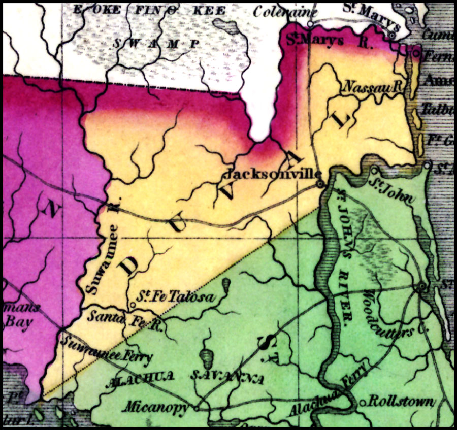
In 1827, a town called St. John was located near this side of town. It may have been up on what is now Blount Island or else in the Beacon Hills area. It's hard to tell. I can't see any remnants of the town now. The town also was not on later maps of the area. It seems to reappear in an 1839 map.
An 1842 map lists Mandarin and Julington in the general Jacksonville area, but Julington Creek is down in Mandarin, which isn't really close to this area. With both of these names in italics, I assume they are both rivers being listed. Colt seems to be the name of the town near where Mandarin currently is located. There is a Colt Street in Arlington, but not sure if it's related.
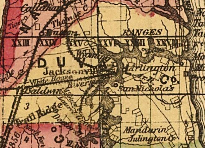
By 1874, there's some development east of the river, and Mandarin is joined by Arlington and San Nickolas. St. Nicholas is a neighborhood in the San Marco area, so that's probably the same. The map also seems to show the Arlington River flowing all the way to the ocean, or at least the intracoastal. I wonder if that's mistake or what.
By the 1880s, Beauclerc is showing up in between Mandarin and St. Nicholas. All along the river still. However, Pablo Beach is now being listed where The Beaches are today, so probably some Northern industrialists sunning themselves in the winter after taking a steamship down to Jax.
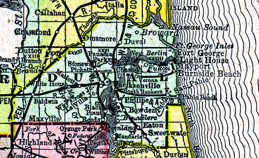
In 1888, there seems to have been several new towns listed east of Jacksonville. San Pablo was just west of Pablo Beach, probably near San Pablo Rd. Fulton and Verona have also popped up seemingly near Arlington. The coordinates for Fulton (30.384 -81.493) place it a few blocks from The Fort Caroline National Memorial. I can't find Verona, but I'd say it's near the Arlington Regency Mall. Maybe the mall will get redeveloped into Verona Apartments someday.
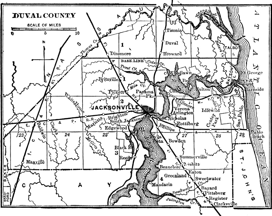
Gilmore, which seems to be near the Dames Point Bridge, and Chase, which was in the University Park area, can also be found on maps starting in the late 1800s. Cosmo is the area around Ed Austin Park (The Dunes). The 1890 map is also when I see first mention of something within a mile of where we live: Idlewild. When I research it, there seems to be an old cemetery within walking distance of our house that probably has a subdivision sitting above it, like in Poltergeist. Luckily, the coordinates for the cemetery seem to be at least a half mile from our house.
I was using an app on my phone that said the weather for my location was based on Fulton, with my neighbors down the block are Cosmo. Fulton seems to be based around Fort Caroline, though I never saw the city name on older maps.
While looking through old maps, I also found that the apostrophe in St. Johns (John's) started disappearing around 1900. I guess it was like, new century, new name.
Anyhow, we live in East Arlington / Intracoastal West / Idlewild / Fulton, Jacksonville, Duval.


